Metadata Catalogue
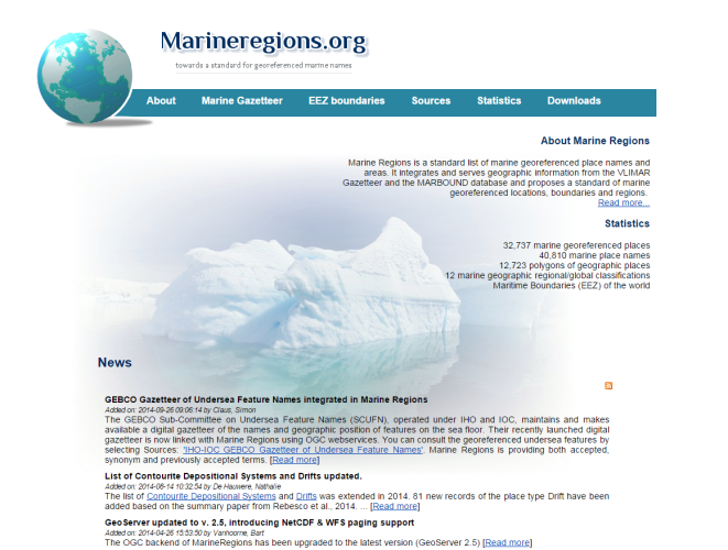
Marine Regions
The purpose of Marine Regions is to create a standard, relational list of geographic names, coupled with information and maps of the geographic location of these features.
Marine Regions is an integration of the VLIMAR Gazetteer and the VLIZ Maritime Boundaries Geodatabase (MARBOUND). The VLIMAR Gazetteer is a database with geographic, mainly marine names such as seas, sandbanks, seamounts, ridges, bays or even standard sampling stations used in marine research. The geographic cover of the VLIMAR gazetteer is global but initially focused on the Belgian Continental Shelf and the Scheldt Estuary and the Southern Bight of the North Sea. Gradually more regional and global geographic information was added to VLIMAR and combining this information with the Maritime Boundaries database, representing the Exclusive Economic Zone (EEZ) of the world, led to the creation of marineregions.org.
In order to preserve the identity of the marine geographic objects from the database, and to name and locate the geographic resources on the web, MarineRegions promotes the Marine Regions Geographic IDentifier, or the MRGID.
Developed by:
Marine Regions is managed by the Flanders Marine Institute (VLIZ). Funding for the creation of the VLIMAR gazetteer was provided initially through the EU Network of Excellence MarBEF, but also other European initiative such as EMODNet and LifeWatch provide the necessary funding for the maintenance and management of Marine Regions.
Used data resources:
Marine Regions uses several sources: marine boundaries, ecological classifications, fishing zones, thematic gazetteers, regional gazetteers, global gazetteers and several others.
Web services:
Marine Regions provides numerous web services which allow the user to have direct access to the geographic data, maps and metadata from a GIS desktop or for online applications. Currently Marine Regions provides the OGC services WMS, WFS and CSW.
Default
- Date ( Publication)
- Status
- Completed
- Keywords
-
marine
- Keywords
-
Gazetteer
- Access constraints
- License
- Use limitation
- OnLine resource
-
Marine Regions Web address
(
WWW:LINK-1.0-http--link
)
- Service Name
-
mregions2 R package
- Service Description
-
mregions2 provides access to the data from http://www.marineregions.org in R. It uses both the Marine Regions Gazetteer Web Services and the Marine Regions OGC Web Services in R.
mregions2 superseedes the previous mregions R package.
- Service Reference (id)
- Service Name
-
Belgian LifeWatch eLab
- Service Description
-
One of the virtual laboratories developed by LifeWatch Belgium is the Belgian LifeWatch eLab.
This online application allows users to standardise, analyse and visualise their data, making use of web services built on top of internal and external reference databases.
The ultimate goal of LifeWatch is to set up a network for data exchange and data analysis through web services. Web services are systems that allow communication between two computers over the web, and allow the user to access the most recent and up-to-date information directly from within other applications.
Within LifeWatch Belgium, several web services are available to standardise, analyse and visualise your data, and to extract additional data from several sources. The user can select several data services (taxonomic, geographic, thematic, etc.) and run them successively through a straightforward online user interface.
You can also use the LifeWatch.be web services in a concatenated way, i.e. the output of one web service is the input for the next web service. Establishing such workflows helps solving (complicated) biological questions. Several use cases demonstrate the use of the LifeWatch web services.
So as to facilitate the use of the LifeWatch web services, several applications and tools were documented in use cases and tutorials. These can be found on the links below, as well as on the specific websites of software packages and Github repositories.
The Belgian LifeWatch E-Lab online application allows users to standardize, analyze and visualize their data, making use of web services built on top of internal and external reference databases. A user can select several data services (taxonomic, geographic, thematic, etc.) and run them successively through a straightforward user interface. As explained in the user guide, the LifeWatch.be web services can be used in a concatenated way, i.e. the output of one web service is the input for the next web service.
- Service Reference (id)
- Service Name
-
mregions R package
- Service Description
-
mregions provides access to the data from http://www.marineregions.org in R. It uses both the Marine Regions Gazetteer Web Services and the Marine Regions OGC Web Services.
mregions can help in a variety of use cases:
- visualize marine regions alone;
- visualize marine regions with associated data paired with analysis;
- use marine region geospatial boundaries to query data providers (e.g., OBIS: http://www.iobis.org);
- Geocode: get geolocation data from place names;
- reverse Geocode: get place names from geolocation data.
- Service Reference (id)
- Service Name
-
Marine Regions Gazetteer Web Services
- Service Description
-
Dealing with different names of geographic features or entities, VLIZ developed a standard, relational list of geographic names, coupled with information and maps of the geographic location of these features. The purpose of the gazetteer is to improve access and clarity of the different geographic, mainly marine names such as seas, sandbanks, ridges, bays or even standard sampling stations used in marine research. The geographic cover is global; however the gazetteer is focused on the Belgian Continental Shelf, the Scheldt Estuary and the Southern Bight of the North Sea.
The Marine Regions Gazetteer is accessible both for humans and machines in different ways:
- through the web portal by means of the search engine interface;
- through REST APIs;
- through SOAP calls;
- through Linked Data Event Streams;
- through an ad-hoc developed R Package: 'mregions'.
Metadata
- File identifier
- 6f56ffa6-cf3b-4a8c-b8ed-dcb4e84ebc07 XML
- Metadata language
- en
- Hierarchy level
- Virtual Research Environment
- Metadata Schema Version
-
1.0