Radar Aeroecology Virtual Lab
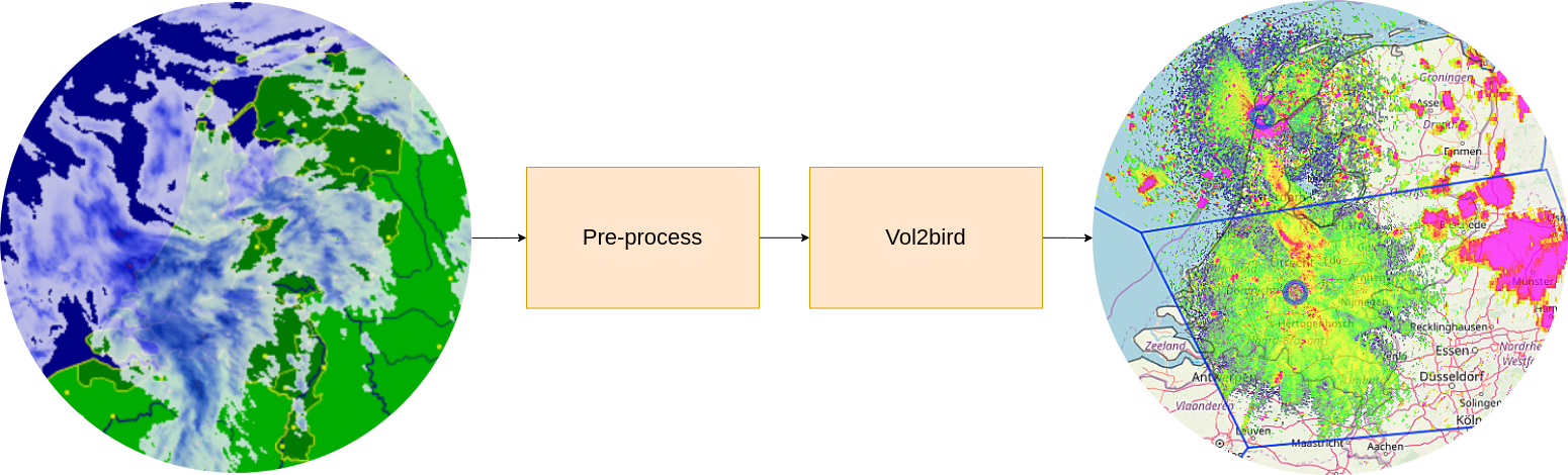
The airspace is becoming increasingly crowded. High-rises, wind farms and airports all contribute to conflict with aerial organisms. <div>Information about the movements of organisms in the air is required to identify stop-over sites, migratory routes, and patterns. This can inform mitigation of conflicts by, for example, wind-turbine curtailments or early warning systems for aviation. Weather radars, that continuously monitor the sky across continents, can be used to study movements of birds, bats, and insects. However, for continental scale analysis, large volumes of data are required to be processed and analyzed, which often rely on institute-specific tools and computational resources. </div>This severely hampers collaborative efforts because of the initial investment of time and resources to gain access to existing computing infrastructure. The Radar Aeroecology Virtual Lab (RAVL) facilitates collaboration and re-use of infrastructure and tools.<div>The vLab has been created by using the LifeWatch NaaVRE platform (<a href=" https://naavre.net" target="_blank"> https://naavre.net</a>/) .</div>
Default
- Date ( Publication)
- 2026-02-03
- Status
- On going / operational
- Keywords
-
Aerial animal movement
- Keywords
-
Biological scatter
- Keywords
-
Bird migration
- Keywords
-
Radar ontology
- Keywords
-
Weather radar
- Keywords
-
Altitude profile
- Access constraints
- License
- OnLine resource
-
Link to the virtual lab
(
WWW:LINK-1.0-http--link
)
- OnLine resource
-
Open NaaVRE
(
WWW:LINK-1.0-http--link
)
metadataMetadata
- File identifier
- 33c185f3-15d0-417d-824f-10ee8bc7d14a XML
- Metadata language
- en
- Parent identifier
-
NaaVRE - Notebook as a Virtual Research Environment
642002de-0be8-4509-9375-a83ecae395cc
- Hierarchy level
- Virtual Research Environment
- Metadata Schema Version
-
1.0